

If you are like me, there are many countries whose name you have pondered upon. One of them is Morocco! I have wondered about the name Morocco and its origin: was it a Portuguese or Spanish adaptation? did the French version ‘Maroc‘ derive from a Berber word or Almoravid name? Or was it a European name given to an African land? How did the initial inhabitants call their land?

Well, the word ‘Morocco‘ derives from the Berber Ameṛṛuk, the shortened version of « Amurakuc », the original name « Marrakesh», itself arising from the Berber « amur n ukuc » meaning «land of God» or «sacred land». The full Arabic name al-Mamlakah al-Maghribiyyah translates to “Kingdom of the West” or the “Kingdom where the sun sets.” For historical references, medieval Arab historians and geographers sometimes referred to Morocco as al-Maghrib al-Aqṣá (meaning “The Farthest West“) to distinguish it from neighboring historical regions called al-Maghrib al-Awsaṭ (meaning “The Middle West“) and al-Maghrib al-Adná (meaning “The Nearest West“). Marrakesh was Morocco’s capital under the Almoravid dynasty and Almohad Caliphate. In Turkish, Morocco is known as Fas, a name derived from its ancient capital of Fes. However, this was not the case in other parts of the Islamic world: until the middle of the 20th century, the common name of Morocco in Egyptian and Middle Eastern Arabic literature was Marrakesh; name still used in some languages such as Persian, Urdu and Punjabi. The English name Morocco is an anglicisation of the Spanish and Portuguese Marruecos and Marrocos respectively; which all derived from Marrakesh.

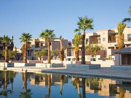
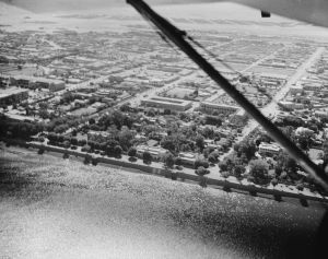
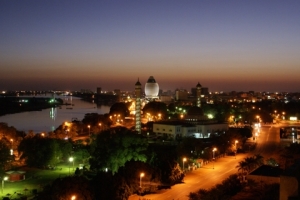
Morocco’s capital, Rabat (Source: visitMorocco.com)
Morocco was known as the Kingdom of Marrakesh under the three dynasties that made Marrakesh their capital. Then, it was known as the Kingdom of Fes, after the dynasties which had Fez as their capital. In the 19th century, European cartographers still mentioned a “Kingdom of Morocco“, indicating the ancient capital “Morocco” (for Marrakesh). Under the Alaouite dynasty, the country moved from the appellation to the Empire of Sharif in the 19th century, to that of Kingdom of Morocco.

Morocco is a monarchy, and is governed today by the King of Morocco, Mohammed VI, who holds executive and legislative powers, especially over the military, foreign policy and religious affairs.
Morocco has a coast by the Atlantic Ocean that reaches past the Strait of Gibraltar into the Mediterranean Sea. It is bordered by Spain to the north (a water border through the Strait and land borders with three small Spanish-controlled exclaves, Ceuta, Melilla, and Peñón de Vélez de la Gomera), Algeria to the east, and the annexed Western Sahara to the south. Since Morocco controls most of Western Sahara, its de facto southern boundary is with Mauritania.
The capital of Morocco is Rabat; and its largest city is its main port, Casablanca. Other major Moroccan cities are Fes, Marrakesh, Meknes, Salé and Tangier. Morocco has become a major player in African economic affairs, and is the 5th African economy by GDP (PPP). Tourism accounts for a big part of its economy. Morocco is an ethnically diverse country with a rich culture and civilisation; and this diversity can be seen in its architecture, and cuisine as well.
Next time you visit Morocco, do not forget to enjoy its rich culture, cuisine, beautiful scenery, and remember that its name stands for the Land of God or the Sacred land, and enjoy its sacred treasures.

 On ne conduit pas chez le coiffeur un enfant qui n’est pas encore né


 So
So 


