Why the Name: Pointe-Noire?

Map and Flag of the Republic of Congo

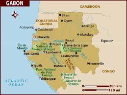
Have you ever wondered why the second city of the  Republic of the Congo‘s name is Pointe-Noire? After all, why would a city in Congo be named Black point? Is there a volcanic mountain in the city, whose tip is black? Or does the city extend through the bay while making it so hard to distinguish that sailors of the past could have called it Black point, because maybe they could not see it, and just crashed into its coasts? Or is it the French translation to a local word? All those questions are quite valid ones.

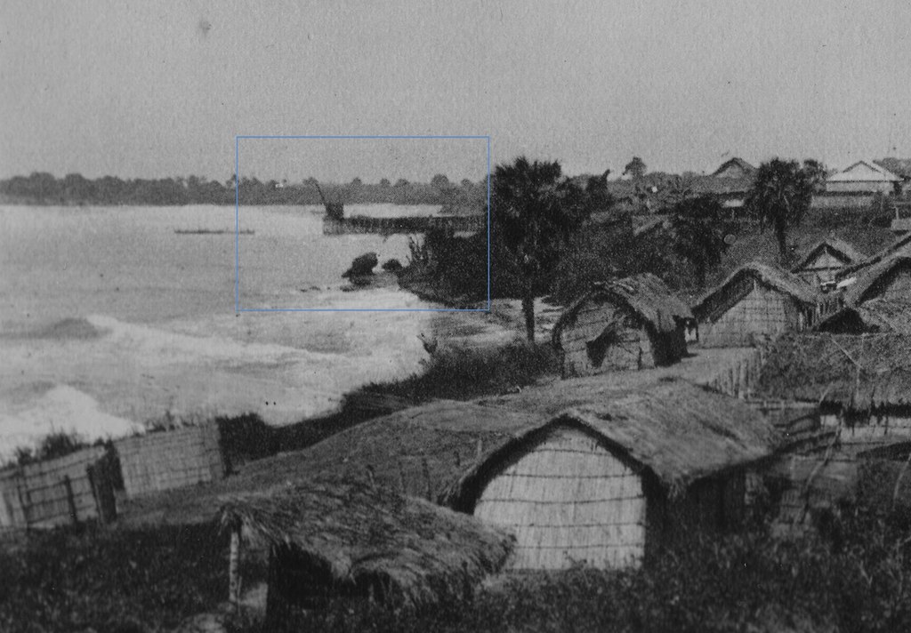
It turns out that the city of Pointe-Noire got its name from the Portuguese navigators who saw a block of black rocks on the headland in 1484. They named the place Ponta Negra (as it first appeared on maps), which became Punta Negra in Spanish, which later became Pointe Noire in French. It became a maritime point of reference for the Portuguese sailors, and later in 1883 it became a small fishing village, after the French signed a treaty with the local Loangos people. Pointe-Noire is nicknamed Ponton or Pontoon by its inhabitants, or Ndji-Ndji or Njinji, in reference to the ancient village of fishermen on which the city is built. It is located between the small bay of Pointe-Noire Bay and the Atlantic Ocean

Wharf of Pointe-Noire in 1924 (Wikipedia)

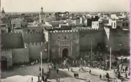
Over the years, the city of Pointe-Noire overtook the place of Loango located about 15 km away, which used to be the capital of the great Loango empire (story for another day). First in 1910, the French Equatorial Africa (Afrique équatoriale française, AEF) was created, and French companies started exploiting the Middle Congo (modern-day Congo Brazzaville) in that region, then there was a need for the creation of a railroad that could link Brazzaville inland to the Atlantic ocean. In 1923, Pointe-Noire was chosen to be the

Railway Station of Pointe-Noire in 1947 (Wikipedia)

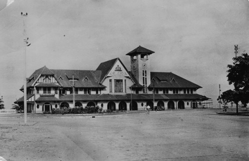
terminus of the Congo-Ocean Railway, instead of Libreville. The city was also chosen to be the AEF seaport as opposed to Loango (this marked the forever decline of Loango). In 1950, Pointe-Noire had 20,000 inhabitants, and became the capital of the Middle Congo, while Brazzaville was the capital city of the AEF. It was the most modern city in Congo by 1960. Oil discoveries and the implantation of Elf Aquitaine (now Total Energies) in the 1980 have created an economic boom for the city, and influx of populations especially after the civil war of 1997 between Pascal Lissouba and Denis Sassou Nguesso. It is good to note that the oil of Congo belongs to France, and this was the reason of the 1997 war between Lissouba and Sassou Nguesso, because Lissouba wanted fair compensation for Congolese oil, and sought an American company to exploit oil (The 11 Components of the French Colonial Tax in Africa).

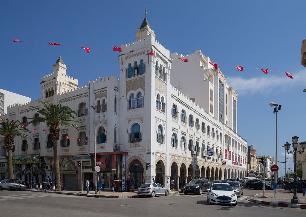
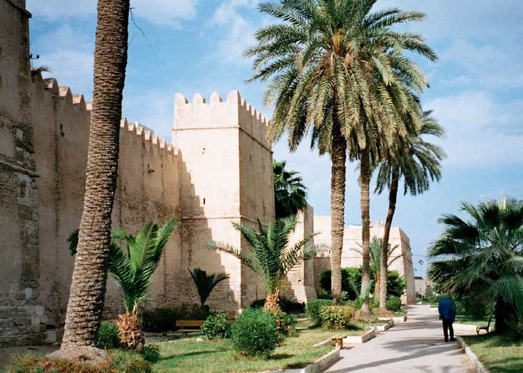
Today, Pointe-Noire is a very modern city whose main industries are still oil, the seaport, railway, and fishing; it also has a large potash industry as well. Pointe-Noire is the economic lung of the country. A while back, we visited Pointe-Noire, and were amazed by the difference between Pointe-Noire and Brazzaville; it is better built, and organized. It also has a large expatriate community. In the past it was left untouched by the civil unrest that shook the entire country. The city has two distinct sides, with the European quarter and the African quarter (La Cité) offering wholly different feels – Pointe-Noire is a great example of urban dimorphism if there ever was one. As you visit Pointe-Noire, and walk on its sandy beaches, enjoy the city, and if you have time, try to look for that Black Point after which it was named.

Why the Name : Saint-Louis ?

Aerial view of Saint-Louis (Source: Wetlands.org)

When you hear the name Saint-Louis, what comes to mind? If you are thinking about the city with the Gateway arch, that city in the United States of America, St Louis,… then think again… today we will talk about the other Saint-Louis, the city located in Senegal, which used to be the capital of the French colony of Senegal from 1673 to 1902. You heard right… so Saint-Louis in Senegal is actually much older than the American St Louis.

View of the Saint-Louis Fort from the sea, from “L’Afrique ou histoire, moeurs, usages et coutumes des Africains”, by René Claude Geoffroy de Villeneuve, 1814

The city of Saint-Louis is the capital of Senegal’s Saint-Louis Region, and is located in the northwest of the country, near the mouth of the Senegal River, 320 km from the capital Dakar, on the border with Mauritania. The city was named after Louis IX, a 13th century king of France, and also in honor of Louis XIV who was the monarch at the time of the island’s settlement by France in 1659. It was the first city founded by Europeans in West Africa; before then, there were Portuguese, Dutch, English traders in the area, but they had not yet ‘founded’ cities. The city was originally known as Saint Louis of the Fort (St-Louis-du-Fort) after its fort. At least 200 years prior to the European arrival in the area, the site was an Wolof settlement known to locals as Ndar or N’dar which is Wolof for island. With the arrival of Europeans, the city became an important trade center for gold, gum Arabic, ivory, and slaves in Africa.

Downtown Saint-Louis, Rue Lebon, 1900

Nicknamed the “African Venice,” it is no surprise that Saint-Louis acquired the status of UNESCO World Heritage Site in 2000. Since then, the city has been working on renovation of ancient buildings, transforming some of the warehouses into hotels and restaurants. The city still has a lot of houses from the colonial era. It is divided into three parts: N’Dar’s island (the historical part of the city) which is connected with a bridge to the fishing village in the peninsula Guet N’Dar (the

View of Saint-louis showing its different neighborhoods (Source: Baobabtourisme.com)

Langue de Barbarie) and to the continental part with another bridge. The heart of the old colonial city is located on a narrow island which is a little more than 2 km (1.2 mi) long but only about 400 m (1,300 ft) wide. The island lies in the Senegal River. It is 25 km (16 mi) north of its mouth, but is only separated from the Atlantic Ocean to its west by the Langue de Barbarie, a 300 m (980 ft) wide sand spit. The Langue de Barbarie is the location of the seaside neighborhoods Ndar Toute and Guet Ndar. On the mainland, the east bank of the river is the site of Sor, an older settlement now considered a suburb of Saint-Louis. It is nearly surrounded by tidal marshes. Three characteristics give Saint-Louis its distinctive geographic appearance: the Sahel, the marshes, and the Langue de Barbarie.

A Signare or Negresse of quality from the Island of Saint Louis in Senegal, accompanied by her slave, Illustration from Costumes civils de tous les peuples connus, Paris, 1788, by Jacques Grasset de Saint-Sauveur

One cannot talk of Saint Louis without mentioning the Signares. Deriving from the Portuguese Senhora, Signares were the women of mixed descent, French/Senegalese, also known as Métis, who formed a class of entrepreneurs women who managed to gain some assets, status and power in the hierarchies of the Atlantic slave trade. They were important in the economic, cultural and social life of the city. They created a distinctive urban culture characterized by public displays of elegance, refined entertainment and popular festivities. There are still families descending from these women entrepreneurs of the 18th and 19th centuries.

Some big attractions apart from the city itself include the National Park Langue de Barbarie which is in the southern tip of the peninsula, and covers a total surface of 2000 hectares, and the Djoudj National Bird Sanctuary which is the third largest bird sanctuary in the world, with species emigrating there from Europe, Asia, and East Africa.

If you are ever in Senegal and would like to head north of Dakar, please take the time to visit Saint-Louis, and bathe in the mix of old colonial French style and the teranga (hospitality) so well known to Senegalese people. To learn more about Saint-Louis, check out: Saint-Louis du Senegal, UNESCO World Heritage Site, and my favorite on Spirited Pursuit.

Why the Name: Zambia?

Zambian flag
Zambian flag

Have you ever wondered about the name of the country Zambia? Think about it: ZAMBIA… so much power in the name. It is the second to last country in the alphabetical list of countries, before Zimbabwe. Just like Zimbabwe which was Southern Rhodesia, Zambia was formerly known as Northern Rhodesia; both countries shared the Rhodesia name.  Why bother changing names you might ask?

Kenneth Kaunda
Kenneth Kaunda, first president of Zambia

Well, Rhodesia was named after the infamous British Cecil Rhodes who committed atrocities in Southern Africa, while establishing British rule over the different countries. It only made sense that, when Zambia got its independence from the British on 24 October 1964, that the African rulers would want a name that represented them and their values, and not some man who killed them; moreover, being called ‘Northern something’ is like not having a real identity. Thus, in 1964, the country’s first president, Kenneth Kaunda changed the name from Northern Rhodesia to Zambia. ZAMBIA‘s name comes from the Zambezi River, where Zambezi means “grand river“, as it is the 4th largest river in Africa after the Nile, Congo, and Niger rivers.

Skull of the homo Rhodesiensis or Kabwe skull found in Zambia

The capital of the country of Zambia is Lusaka. Zambia is rich in prehistoric vestiges including the skull of the homo rhodesiensis also known as the Broken Hill Man which is dated 100,000 to 300,000 years and found in a zinc mine in the city of Kabwe in 1921. The first inhabitants of the area, in more modern times, were the San and Batwa people until around AD 300. Later on, it has been the site of early Bantu settlements. These early Bantu settlers participated in trade at the site of Ingombe Ilede (which translates to sleeping cow in the Tonga language because the fallen baobab tree resembles a cow) in Southern Zambia. Ingombe Ilede was one of the most important trading posts for rulers of Great Zimbabwe. Zambia has been at the crossroads of populations in Southern Africa, seeing the rise of several large kingdoms over the centuries.

Zambia's national team, the Chipolopolo
Zambia’s national team, the Chipolopolo

Zambia is a landlocked country in southern Africa, with a tropical climate, consisting mostly of high plateaus with some hills and mountains, dissected by the great Zambezi river. Copper represents almost 70% of the country’s exports. It is the home of the Chipolopolos, rightfully named the copper bullets once led by the great Kalusha Bwalya. If you visit Zambia, do not forget to bask in the welcome of its inhabitants, try and find your way near the Zambezi River, visit the capital Lusaka, learn a few words in one of the local languages, and at least one find out why the country is so well-known for its copper. Enjoy the 10 best places to visit in Zambia (There are much more, of course)!

Why the Name : Kigali?

Rwanda_map3
Map of Rwanda (Source: WorldAtlas.com)

Have you ever wondered about the meaning of the name Kigali, the capital of Rwanda? Is the name from the ancient Kingdom of Rwanda? Was Kigali its capital? Or is it the name of a local town the colonizer decided to turn into the seat of a new protectorate state in Africa?

Rwanda_Kigali
Boulevard in Kigali, Rwanda

Well, Kigali takes its name from Mount Kigali at the foothills of which the city is located. In Kinyarwanda, the prefix ki- denotes objects, while the adjective –gali means ‘vast’, ‘broad’, ‘wide’. Thus the translation of the name Kigali yields ‘great or big mount’ or ‘vast mountain,’ because the mountain itself is broad and wide. However, based on oral tradition, it is said that the name might have originated in the 14th century when local king Rugwe after conquering the area stood on top of the hill and stated “burya iki gihugu ni Kigali,” which translates to “this country is vast.” Note that the capital of the Kingdom of Rwanda was never Kigali, but Nyanza.

Rwanda_Kigali_City Hall
Kigali City Hall, Kigali, Rwanda

The city was established in 1907 by the German administrator and explorer Richard Kandt, who chose Kigali for its central location, and good views of the entire region (security-wise). Perched at an altitude of 1500 m, Kigali is made up of rolling hills and valleys, thus it is quite a strategic point. Kandt’s house was the first European house in the city, and is still in use today as the Kandt House Museum of Natural History. Very often to destroy the power of traditional and local kingdoms, colonial main cities and capitals were chosen away from the usual centers of power which might have carried a lot of the indigenous people’s traditions and thus caused a resistance to the colonial rule; this could also explain the choice of Kigali as the capital.

Rwanda_Kigali_Genocide Memorial
Kigali Genocide Memorial, Kigali, Rwanda

Kigali became the capital upon independence in 1962. Two other cities were considered as contenders for the title of capital, Nyanza the seat of the Mwami and the capital of the ancient kingdom, and Butare which was considered a cultural and religious center. Yet again Kigali won over the other two because of its central location. Over the years, Kigali has grown and expanded.  However, the Rwandan civil war and  Rwandan genocide of 1994 cast a dark cloud over Kigali, the Rwandan sky, and the entire sub-region. Over 800,000 people died during that time, which marked one of the darkest times in the history of the country. Today, one can still visit the Genocide Memorial in Kigali to remember those whose lives were taken.

Rwanda_Kigali_Hotel des Mille Collines
Hotel des Mille Collines which at the height of the 1994 genocide housed over 1200 Hutus and Tutsis refugees, and was made famous by the movie Hotel Rwanda with his general manager Paul Rusesabagina who has been abducted from exile in 2020 and is currently jailed in Kigali by the Kagame regime

Today, Kigali has expanded tremendously, and grown significantly. Much of the city has been rebuilt, and today flourishes. It is the economic and financial hub of the country. In 2013, the economy was reported to be dependent on foreign aid and illegal resource extraction from the DRC. I once read comments from a member of the Rwandan financial ministry who explained that they were finding new precious stones or minerals every day on Rwandan soil… in reality, it is from neighboring DRC.

Overall, Kigali knows cooler temperatures than most countries around the equator, because of its high elevations. The city is particularly lauded for its cleanliness, innovation, and foreign investments. The quick turnaround and rebuilding of Kigali and Rwanda as a whole has made it a key player in all continental organizations. Although many criticize the government of Paul Kagame, it is no doubt that Kigali and Rwanda have experienced undeniable growth, thanks to a combination of the neighbor’s wealth and good governance.

Rwanda_Kigali_Amahoro Stadium
Amahoro National Stadium entrance in Kigali, Rwanda

If you visit Kigali and Rwanda as a whole, please make sure to check your plastic bags at your point of origin as plastic bags are prohibited on Rwandan soil. Make sure to visit the Kigali Genocide Memorial, the Amahoro Stadium, the Presidential Palace Museum which was the abode of past president Juvénal Habyarimana, the Muslim mosque of the city, and the different craft centers. The city expands along all the different hills, and so make sure to ride around on the moto-taxis or use public transportation, and do not forget to buy the famous agaseke baskets for which Rwandans and Burundians are known for.

Why the Name: Sfax ?

View of Sfax from Ksar Ben Romadhane (Source: Wikipedia)

I have always loved the name of the second city of Tunisia, Sfax… think about it for a second: S-FAX… the name does not seem to sound one bit Arabic… it would seem so reminiscent of Rome…


Well, it is said that a  Cucurbitaceae gourd plant (such as a cucumber) gave its name to the city of Sfax, or rather that fakous which means cucumber in a local Tunisian language (most likely Berber) gave rise to the name Sfax.

Bab Diwan and Old view of Sfax in 1954

Thomas Shaw who visited Tunis in 1732 claimed in his book Observations geographiques sur le royaume de Tunis, Voyages de M. Shaw dans plusieurs provinces de la Barbarie et du Levant, ed Jean Neaume, La Haye 1743, P. 249, that, “Sfakès is the city of cucumbers.”

However, in his book Fastes chronologiques de la ville de Sfaks, Antoine du Paty de Clam, mentioned that Sfaks could be decomposed into s fa ekez, meaning in Berber, « the one who extends the surveillance » and whose Greek translation is equivalent to Taphrouria (look-out post or monitoring station or surveillance post) transcribed to Taphrura by historians such as Ptolemee.

View of the Medina in Sfax

Other historians have assumed that the name of Sfax must have originated from the name of the governor of the city, Sfâ. According to them, the governor of the city went to visit the Sultan of Mahrès (Mahares) to solicit his help in building the city’s ramparts to protect it from invasion; he exposed his plan on a cow hide that was drying under th sun. In response, the sultan gave him a pair of scissors while saying, “Sfâ qoçç” or “Sfâ cut!”

So which meaning do you think it is?

The city was founded in AD 849 on the ruins of the Roman city of Taparura. It is located on the Mediterranean, and is a major port. The main industries are phosphate, olive, nut (almond) processing, leather, wool, fishing, and international trade. After the capital Tunis, it is the second most populous city of Tunisia. Rich of its prehistoric, Roman, and Islamic heritage, Sfax is a vibrant port city full of life. If you ever visit Sfax, do not forget to visit its museums, enjoy the history, and the city, and maybe look for a fakous?

How to Sign over a River? : British Colonial Treaties in Africa – The Case of the Gambia River

Map and Flag of The Gambia

As I read more colonial treaties signed on the continent, it is hard for a modern mind to understand the concept of ceding over rivers. How do you know where the river ends? Is the river part of just one kingdom? What do you do when it is split among several kingdoms? Did the Europeans take that into consideration, if they only had the signature from one king, and not others? Or did they just cause war to get the remainder of the river? What do you think?

Below is the example of the Gambia River.

On the 3rd September, 1783, a Treaty was concluded between Great Britain and France, by Article X of which the King of the French guaranteed to the King of Great Britain the possession of Fort James (Albreda) [located on modern-day Kunta Kinteh Island] and of the River Gambia.

====

Cession of the River Gambia to Great Britain. (The map of Africa by Treaty, Vol 1, P.367 – 368)

On the 15th June, 1826,+ a Convention was signed between the Acting Governor of Sierra Leone and the King of Barra and of the River Gambia, with his Chiefs and headmen, for the cession of the Gambia to Great Britain.

Map of the River Gambra (now Gambia) in 1732

It contained the following stipulations:

* * *

“ 2nd. The said Brunay, King of Barra, by and with the advice and consent of his Chiefs and headmen before named, cedes, transfers, and makes over to his Honour Kenneth Macaulay, Acting Governor of  Sierra Leone, and his successors, Governors of Sierra Leone for the time being, on the part and behalf of His Majesty the King of the United Kingdoms of Great Britain and Ireland, his heirs, and successors forever, the full, entire, free, and unlimited right, title, sovereignty; and possession of the River Gambia, with all the branches, creeks, inlets, and waters of the same, as they have been held and possessed by the Kings of Barra from time immemorial ; and the said Brunay, King of Barra, with the advice and consent of his said Chiefs and headmen as aforesaid, does further cede and forever relinquish all and every right, claim, or demand for customs or duties of any description on British or other vessels entering or navigating the River Gambia, or any of the waters thereof (as have been formerly demanded and taken).

+ S.P., vol. xlviii, p. 882; H.T., vol. xii, p. 5. See also Treaties, 6th January, 1832, p. 824, and 18th November, 1850, p. 326.

Why the Name : Banjul ?

Map and Flag of The Gambia

Have you ever wondered what the name of the capital of The Gambia, Banjul, could mean? To me, the name sounds like it has some strength into it… try it: “BANGJUL.” Well, it turns out that Banjul takes its name from the Mandé people who gathered specific fibers on the island, which were used in the making of ropes. Bang julo is the Mandinka (Mande) word for rope fiber. The mispronunciation of this word led to the name Banjul.

Bathurst (modern-day Banjul) in 1824

As we learned earlier in the week (A Polish-Lithuanian or Latvian Colony in Africa?), the King of Kombo leased the area encompassing modern-day Banjul to the Duke of Courland in 1651. One could say that Banjul was a vassal possession of the Polish-Lithuanian Commonwealth or Latvian colony in Africa. Prior to 1816, Portuguese referred to the area as Banjulo, while the British called it Banjola. In 1816, the then king (Mansa) of Kombo, Tomani Bojang, ceded the area to Alexander Grant, a British commander, who turned it into a trading post and base to control the entrance to the Gambia estuary, enforce the Slavery Abolition Act, and protect British commercial interests in the region. The British first named the area St Mary’s Island (then known as Banjulo by the Portuguese), and later renamed it Bathurst after the 3rd Earl of Bathurst, Secretary of State for War and the colonies. It became the center of British activity in the Gambia Colony and Protectorate. The town kept the name Bathurst, until independence when it was changed to Banjul in 1973.

A marketplace in Bathurst in 1910

As you look at the painting of Bathurst in 1824, you can clearly see that Gambians were fully dressed, thus once again destroying the idea repeated by Europeans that Africans were roaming naked (Description of African Dressing in 1400s) throughout the continent, or that they did not have a textile industry (History of African Fabrics and Textiles).

Banjul is the capital and fourth largest city of The Gambia. It is located on St Mary’s Island (Banjul Island) where the Gambia River enters into the Atlantic Ocean. It is The Gambia’s largest and most densely populated metropolitan area. It is a vibrant city, with great hospitality. So, as you visit Banjul, remember to look for the fiber that gave its name, and most importantly look to the spirit of the people which is strong, warm, and welcoming. Enjoy!

Why the Name: Port-Gentil?

Map of Gabon

I have always wondered why the second largest city of Gabon is named Port-Gentil… Is it full of kind agreeable souls? Is it a gentle town, very laid-back? Otherwise, why will it be named that way?

Emile Gentil in 1902

Well, to my surprise, Port-Gentil is named after the French colonial administrator Émile Gentil who served there in 1902. I have a lot of doubts that the man was a kind or gentle soul. From stories of these colonial administrators in Africa, many were more on the ruthless and disagreeable side, particularly towards Africans, whom they saw as savages. Indeed, after investigation into Emile Gentil, it turns out that he had been accused of massacres in Congo in 1905, but had been cleared by the Lanessan commission (what are indigenous’ words against a European’s?… particularly in those days); he was also part of the expedition that was trying to conquer Rabah, a powerful warrior leader in Chad. Gentil is best known for heading two military missions to conquer and consolidate territories north, from modern Gabon up to Chad. … Thus it is only a tiny shot to imagine the atrocities left in his wake… So why is the second largest city of Gabon still named after someone like that? Someone who murdered Gabonese, and other Africans? I know, it sounds sweet, “gentil”, but knowing the source of the name and the atrocities committed against the indigenous populations, why keep the name? If “gentle” is so important, why not translate it into the local language, or roll back to the original name, which is Mandji. It absolutely makes no sense for a city on African soil to bear the name of someone who has been accused of massacres by contemporaries on that very land!

Port-Gentil, Gabon

For completeness, Port-Gentil is located on Lopez Island (in the mouth of the navigable Ogooué River) and on a bay sheltered by Cape Lopez, which juts into the Atlantic Ocean. As the nation’s chief port and industrial centre, it is linked by air to Paris and major West African hubs as well as many Gabonese towns. Life in Port-Gentil is much more laid-back than Libreville. It is Gabon’s economic engine, and massive oil and gas rigs loom just off the coast. The city stretches along the beach, is full of pleasant wide streets and a bustling port. One block back from the corniche, Ave Savorgnan de Brazza (named after another European who massacred Africans) has most of the banks, shops and restaurants. Port-Gentil sits on a peninsula; it is actually an island, cut off from the mainland by the delta of the Ogooué River.

Surprisingly, just like many places coveted by Europeans on the African continent, there are no roads connecting Port-Gentil to the rest of the country. How outrageous! How come in 2021, there are no roads connecting the second largest city of a country, the industrial hub, to the rest of it? This seems like a wanted political decision, especially when the country, Gabon, has been the milk cow of Elf, the defunct French oil company (now Total), and is still a big milk cow of France today.

So even though, as always, I would like you to visit the sandy beaches of Port-Gentil, and enjoy the warm hospitality of the Gabonese, I think it is about time that the city be renamed! Lastly, ROADS, connections to the rest of the country are a MUST!!!

Why the Name: Dodoma ?

Tanzania_Dodoma city center
Dodoma city center (Source: The East African)

I always loved the sound of the name Dodoma, the capital of Tanzania: the way it rolls off your tongue like a dearly beloved, like something or someone so sweet and precious… DO-DO-MA, almost like musical notes! So what do you think Dodoma means?

Well, the name Dodoma is derived from Idodomya, a word in the Chigogo (Gogo) language, which means, “it has sunk.” Tradition says that, an elephant once came to drink at a nearby creek, and got stuck in the mud, and gradually sank. It was then that the villagers exclaimed in amazement, “idodomya!” And from that moment, the place was known as Idodomya, the place where the elephant “has sunk.” It later became Dodoma in 1907 when the Germans colonists, who were probably struggling to pronounce Idodomya, came for the construction of the Tanzanian central railway. The layout followed the typical colonial planning of the time with a European quarter segregated from a native village (European-Only Neighborhoods in African Cities before Independence).

Tanzania_Dodoma 1912
Dodoma in 1912 (Source: Museum of World Cultures)

In 1967, following independence, the Tanzanian government made plans to reorganize its then capital Dar es Salaam, which was undergoing rapid urbanization and population growth. In 1974, after a nationwide party referendum, the capital was moved from Dar es Salaam to a more central location to create significant social and economic improvements for the central region and to centralize the capital within the country. With an already-established town at a major crossroads, the Dodoma region had an agreeable climate, room for development and was located in the geographic centre of the nation. Its location in a rural environment was seen as the ujamaa (family-hood) heartland. The ujamaa concept was a concept championed by the first president of Tanzania Julius Nyerere as part of his social and economic development policies: it was to serve as the basis for an African model of development, or African socialism.

Tanzania_Dodoma Julius Nyerere Square1
Julius Nyerere Square in Dodoma

However, over the past 40 years, much of the initial design, and intents never came to fruition, and to this day many government offices and embassies have remained in Dar es Salaam, which remains the economic and the de facto capital of Tanzania.

The story of Dodoma and Dar es Salaam is similar to that of Abuja and Lagos in Nigeria, of Brasília and Rio de Janeiro in Brazil, and even Washington, D.C. and New York City in the United States, to name just a few. In many of these cities, there is always an economic capital which is the lung of the country, which dwarfs the political capital in size and energy. Nonetheless these political capitals are still special and unique.

Well, if you ever visit Dodoma, remember that elephant who sank there, try and visit them in all the national parks of the country, but most importantly remember to take with you the ujamaa spirit!

The African Crow: The Crow with a Nike Collar

Nike Crow_1
A crow snacking on some bread

A few years back, my father was visiting Melbourne in Australia, when he heard a bird crowing around. So he asked an Australian lady nearby what bird that was, and she answered the crow… and my dad went on to tell her that in his country, the crow had a white collar, and sounded just like that… so the lady chuckled and said, “so you have a Nike-collar crow in your country.” So meet the Nike-collared Crow.

Nike Crow_Rwanda_1
Crows in Rwanda

When I first moved to the West, I never understood why people taught of the crow as a bad bird, or rather a bird of bad omen. When I asked, they told me because of its black coat, and black feathers, and because of its cry. This sounded totally weird to me… why? Because in African culture, the crow is not a bad bird, or a bird bringing ominous news. It is actually a good bird. Not only that, but the crow is not an all-black bird, but it has a white collar. I was surprised to find this white-collared bird in Cameroon, in Rwanda, and in other places, thus telling me that the white-collared crow is indigenous to Africa.

With the white collar, isn’t your perception of the crow changed?

Nike Crow_Cameroon_2
Crows in Cameroon