Why the name: Yaoundé?

Yaoundé around the May 20th Boulevard

Yaoundé, the capital of Cameroon and its second largest city after Douala, is often known as “the city with the seven hills” because of the hills surrounding it… but what does it really mean?  Does its name refer to its hills?

Map of Cameroon, with the capital Yaoundé

In Béti, Yaoundé is often called, Ongolo-Ewondo, or the Ewondos’ enclosure (la clôture des Ewondos).  The city was born around 1889, when the German traders implanted a camp in the Ewondo region and called it Sono station after a local Ewondo chief Essono Ela who had offered them hospitality (the Germans had encountered a strong resistance in the Vouté and Eton regions).  Hearing locals from the coast refer to it as Ya-Ewondo or Among the Ewondo (chez les Ewondos), the Germans called it ‘Jaunde’ and it later turned into ‘Yaunde’, and in French Yaoundé.  The station later turned into an administrative region under the leadership of the botanist Zenker who established a detailed map of the area in 1890.  Upon its creation, it was first a scientific post (probably because of the botanist), and later in 1895 became a military and trading post for ivory and rubber.

Yaoundé at night
Yaoundé at night

Yaoundé was not always the country’s capital.  After the 1909 volcanic eruption of Mt Cameroon in Buéa (Gbéa) which was then the capital, and the humid climate of Douala, the Germans decided to move the capital to Yaoundé because of its central location and its milder climate (and of course, no volcano).  After Germany’s defeat in World War I, Cameroon was placed under French (the eastern regions) and British protectorate (the western regions).  Yaoundé consequently became the capital of French Cameroon, and continued as the capital of the Republic of Cameroon after independence (it was first the Federal Republic of Cameroon in 1961, then The United Republic of Cameroon in 1972, which then officially became the Republic of Cameroon in 1984).  From 100 inhabitants on 2 acres on land at the end of the 19th century, Yaoundé is today a vibrant city home to almost 2 million inhabitants.

The Reunification Monument in Yaoundé

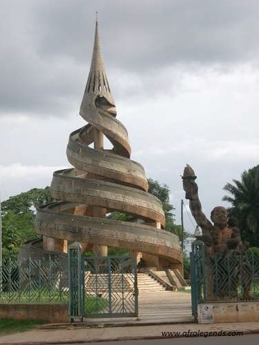
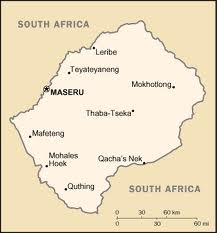
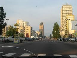
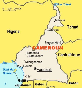
Yaoundé lies at the center of the nation, at about 600 – 1000 m above sea level.  The city first grew around the Mfoundi river.  A network of hills make up its landscape such as Mts Mbam Minkom (1295 m), Nkolodom (1221 m), Messa, Fébé, Akokdoué in the North and West, and Mt Eloumden (1159 m) in the south.  The rivers are the Mfoundi, Ekozoa, Biyeme, and Mefou.  Today, Yaoundé is the siege of power, the presidential palace, the house of parliament, all ministries and embassies. Please enjoy this song of one of Cameroon’s great singers: André-Marie Tala about Yaoundé, and its beauty.  What I have always liked about Yaoundé are its hills (and the red soil):  from the top of one them, other parts of the city can be seen; it gives a feeling of “breathing in” or “taking in” the beauty of the entire city.  Feel the joy of visiting this city which, like Rome has 7 hillsEnjoy the Rome of Africa!

Why the name: Maseru?

Map of Lesotho
Map of Lesotho

Today, I would like us to look into Maseru, the capital of Lesotho, a landlocked country located inside South AfricaMaseru is a Sesotho word which means “the place of the red sandstone.”  Maseru is located on the Caledon river, directly on the border with South Africa.  The city was first established as a police camp, and later on became the capital of the country when it was under British protectorate.  Maseru lies in a shallow valley in the Hlabeng-Sa Likhama foothills of the Maloti mountains.  Its elevation is 1,600 m above sea level.

Flag of Lesotho
Flag of Lesotho

Lesotho is the world’s highest altitude country, in other words, it is the only country in the world which lies 1,000 m above sea level; its lowest point of 1,400 m  is thus the highest in the world.  Over 80% of the country lies 1,800 m above sea level.  Lesotho is the land of the Sotho people, and the official languages are Sesotho and English.

View of Maseru (from visitlesotho.org)

One may wonder how come such a small country (just over 30,000 km2) could reside independently inside South Africa, when we know very well the Boers’ expansion in South Africa and their thirst of land.  Well, in June 1838, when the TrekBoers attacked the country, the King Moshoeshoe I signed a treaty with the British governor of the Cape colony.  After fighting several wars with the Boers from 1858 to 1868, King Moshoeshoe I sought British protection who agreed to make Basutoland into a British protectorate in 1868. In 1869, the British signed a treaty at Aliwal North with the Boers that defined the boundaries of Basutoland, and later Lesotho, which by ceding the western territories effectively reduced Moshoeshoe’s kingdom to half its previous size (see… the colonists never really helped, they just assigned themselves big part of African kingdoms, like that pie Africa became after the Berlin Conference in 1884).  Enjoy this video, and discover Maseru.

Why the name: Dar es Salaam?

Dar es Salaam
Dar es Salaam

I always thought that the name of the Tanzanian city Dar es Salaam had something to do with peace, since it made me think of the Arabic greeting As-salamu alaykum which means peace be upon you .  Great was my joy when I found out that it was indeed true.  Dar es Salaam means ‘the abode of peace‘ or ‘the house of peace.’

Flag of Tanzania
Flag of Tanzania

Formerly Mzizima or ‘the healthy town‘ in Kiswahili, Dar es Salaam is Tanzania‘s largest and richest city today.  It is a regional important economic center.  In the 19th century, it was a coastal fishing village on the periphery of the Indian ocean trade routes.  In 1865, Sultan Majid bin Said of Zanzibar began building a city near Mzizima, and named it Dar es Salaam or harbor/haven of peace with Dar in Arabic meaning house, and es salaam meaning peace.  Dar es Salaam fell into decline after Sultan Majid’s death in 1870, but was revived in 1887 when the German East Africa Company established a station there.  The town’s growth was facilitated by its role as the administrative and commercial centre of German East Africa and industrial expansion resulting from the construction of the Central Railway Line in the early 1900s.

Map of Tanzania
Map of Tanzania

As Germany lost  World War I, German East Africa was captured by the British and from then on was referred to as Tanganyika.  Dar es Salaam was retained as the territory’s administrative and commercial centre.  Under British indirect rule, separate European (e.g., Oyster Bay) and African (e.g., Kariakoo and Ilala) areas developed at a distance from the city center. The town’s population also included a large number of south Asians.  After World War II, Dar es Salaam experienced a period of rapid growth  including political development with the formation of the Tanganyika African National Union or TANU which will lead Tanganyika to independence from British rule in 1961.

Dar es Salaam, once the capital of Tanzania, lost its status of capital city to Dodoma in 1974. Please enjoy the singer Momba who sings Dar es Salaam, and feel at peace in this haven.

Why the name: Algiers?

Algiers at the beginning of the Ottoman rule, 16th century AD

I have often wondered what the name, Algiers, for the capital of Algeria meant.  I always thought it interesting for a capital, and a country to have the same name: Alger (in French) the capital and Algeria, the country.

Modern-day Algiers
Modern-day Algiers

For starters Alger (in French) or Algiers (in English) is a name deriving from the Catalan Alguère, which itself comes from Djezaïr, name given by Bologhine ibn Ziri, founder of the Berber Zirid dynasty who built the city in 944 on the ruins of the ancient Roman city Icosium (or the seagull island), Djezaïr Beni Mezghenna.  The name, as given by Bologhine ibn Ziri, referred to the four islands which laid off the city’s coast until becoming part of the mainland in 1525.  In Arabic, Al-Djaza’ir (الجزائر), “les Îlots” (the Islands), in French “les Iles de Mezghenna” or the islands of Mezghanna  (جزاير بني مزغنا Djezaïr Beni Mezghenna).  According to Middle Ages Muslim geographers, the term island could also refer to the fertile coast of Algeria stuck between the vast Sahara, and the Mediterranean Sea, appearing as an island of life, Al-Jaza’ir.

Basilique 'Notre Dame d'Afrique' in Algiers
Basilique ‘Notre Dame d’Afrique’ in Algiers

Algiers is often nicknamed El-Behdja (البهجة, the joyous), El Mahroussa (the well-kept) or alternatively Alger la Blanche (“Algiers the White”) for the glistening white of its buildings as seen rising up from the sea.  Algiers is located on the west side of a bay of the Mediterranean Sea, also known as the Algiers bay.  The modern part of the city is built on the level ground by the seashore; while the old part, the ancient city of the deys, the Ottoman rulers, climbs the steep hill behind the modern town and is crowned by the casbah or citadel, 122 metres (400 ft) above the sea.  The casbah, which is an ancient neighborhood of Algiers (and a UNESCO World Heritage site), was built on the side of one of the hills that points west of

Carte de l'Algerie (Map of Algeria)
Carte de l’Algerie (Map of Algeria)

the Algiers bay; the casbah and the two quays form a triangle.  Under Ottoman rule, from 1510 to early 1800s, new neighborhoods arose on the hills overseeing the bay.  Algiers and Algeria later fell into French rule in the 1830s, and Algeria became independent on 5 July 1962.

Today, ‘Algiers the White’ is an important vibrant city of almost 4 million inhabitants in North Africa.  It is in essence a joyous city with a glistening white essence on the Mediterranean sea.  Enjoy this video on Algiers.

Why the name: Burkina Faso?

Burkina Faso
Burkina Faso
Flag of Burkina Faso

Have you ever wondered about the name of the country Burkina Faso?  Why would a country have two names, i.e. Burkina and then Faso?  or even simply two names in its history: Upper Volta and then Burkina Faso?  Well, the country named Upper Volta was given a new name in 1984 by then President Thomas Sankara, who chose the name Burkina Faso.

Flag of Upper Volta
Flag of Upper Volta

Originally, Haute Volta or Upper Volta, was just given by the European colonizer, the French, more as an indicator or geographic pointer, and had no real attachment to the people of that region themselves.  Thus Upper Volta was named for the region above the Volta river flowing in the area; the people of that country/area where thus known as the ‘Voltaics’ (Voltaiques in French).  Since the river had three tributaries: the Black Volta, the white Volta, and the red Volta, Upper Volta’s flag also had those three colors.  The Volta river also flew into Ghana, which was never known as the ‘Lower Volta’.  No wonder the name needed to change, as it had no real meaning!

Thomas Sankara
Thomas Sankara a Ouagadougou

Well, on 4 August 1984, Thomas Sankara, with his usual charisma and revolutionary spirit, decided to change the country’s name to Burkina Faso.  He chose two names after two main languages of the country: the Moore (or Mossi language) and the DioulaBurkina from Mòoré means men of integrity, while Faso in Diouala means fatherland.  Thus the Burkina Faso is the land of upright people or the land of honest people.  The people of the country are known as the Burkinabé, where the suffix ‘bé’ comes from the Foufouldé language spoken by the Peulh people (a tribe found in many countries across West Africa), and means ‘men or women’.  Thus, Thomas used three of the main languages in his country to choose a name that was truly representative of the country and its people.  Sankara was then addressed as the PF or the President of the Faso.  The national cloth made up of woven strips of cotton or silk was called faso dan fani (this will be the subject for another post).

Enjoy this video, and travel to Burkina Faso, the land of the upright people.

Why the name: Lusaka?

Map of Zambia
Map of Zambia

Today, I will be talking about Lusaka, the capital of Zambia and its largest city.  The actual location of the city of Lusaka corresponds to that of a village which was named after its chief Lusaaka, and which was located at Manda Hill, near the current site of the Zambian National Assembly building.  In the Nyanja language, Manda means graveyard.

Zambian flag
Zambian flag

The area was expanded by British settlers in 1905 with the building a the railway. Due to its central location and its position on the railway at the crossroads between the Great North Road and Great East Road, Lusaka is chosen to replace Livingstone as the capital of the British colony of Northern Rhodesia (Southern Rhodesia being today’s Zimbabwe) in 1935.  With the fusion of the Northern Rhodesia (Zambia) with Southern Rhodesia (Zimbabwe) and Nyasaland (Malawi) in 1953, Lusaka became the center of independentist movements amongst the educated elite, which eventually led to the creation of the Republic of Zambia.  In 1964, Lusaka became the capital of the newly independent country Zambia, with the country’s first president being Kenneth Kaunda.

Lusaka is not only the capital of the country, but also the capital of the province of Lusaka, which is the smallest and the second most populated of the nine provinces of Zambia.

Lusaka
Lusaka

Today, Lusaka is one of the fastest-developing cities in Southern Africa.  It is the centre of both commerce and government in Zambia and connects to the country’s four main highways heading north, south, east and west, including the famous Cairo Road which is a section of the Great North Road and was so named because it is a link in Cecil Rhodes‘ then dream of a Cape to Cairo Road through British colonies in Africa.  The city is also located at an altitude of 1300 m above sea level.  English is the official language of the city, but Nyanja, and Bemba are commonly used as well.

In recent years, Lusaka has become a popular urban settlement for Zambians and tourists alike.  Check out the map of city of Lusaka, or the newspaper Lusaka Times to get more news about this great city whose name hails from that of a local king.  Enjoy the video below about the city of Lusaka.

Why the name: Nairobi?

Nairobi in 2010
Nairobi in 2010

Have you ever fallen in love with a name? with a place? well… that is the feeling… when you hear the name Nairobi (the capital of Kenya) for the first time, it is like some beautiful girl you were always attracted to but could never get.  Well, the name Nairobi is quite far from that: it comes from the Maasai Enkare Nyrobi which means the place of cool waters, which is also the name for the Nairobi River which lent its name to the city.  Today, it is popularly known as the Green city in the sun… probably because of its lush-ness.

Flag of Kenya
Flag of Kenya

Nairobi hosts a natural reserve protected, the Nairobi National Park, within its borders.  It is also the capital hosting the most species of birds in the world.  Nairobi was originally built at the beginning of the 1900s as a railway link between Mombasa (on the coast of Kenya) and Kampala (Uganda) by the rail company Kenya Uganda Railway.  It was completely rebuilt in the early 1900s after an outbreak of plague and the burning of the original town.  Its location was chosen because of its central position between Mombasa and Kampala; it was also chosen because its network of rivers which could supply the British camp with water and its elevation which would make it cool for the British residential purposes.

Map of Nairobi
Map of Nairobi
Nairobi from Nairobi National Park
A girafe looking onto Nairobi, from Nairobi National Park

In 1905, Nairobi replaced Mombasa as capital of the British protectorate, and from then on grew tremendously around tourism, administration, and big game hunting.  Britons came to live in Nairobi for for game hunting.  In those times, the city quickly became the commercial centre for the colony’s coffee, tea, and sisal industry. Today, Nairobi is one of the most populous cities in Africa known for its beauty, for its versatility, and also for its slum Kibera.  The city of Nairobi is located on the eastern edge of the Rift valley, with the Ngong Hills located to the west of the city, and Africa’s two tallest mountains, Mount Kenya and Mount Kilimanjaro are located to the north and towards the southeast, respectively.  It was also the birthplace of Kenya’s first president, Jomo Kenyatta.

Enjoy the great Congolese singer M’Bilia Bel (she is also a beauty) singing about the beautiful Nairobi, Nakei Nairobi, a song written and composed by Tabu Ley Rochereau.

Have you ever been to Nairobi? What were your impressions?

Why the name: Marrakesh?

Marrakesh
Marrakesh

What comes to mind when I say Marrakesh?  Well, for starters, when I hear the name Marrakesh, my mind is immediately submerged by thoughts of Arabian nights, Mediterranean scents, spices and flavors, camels, oasis, couscous, men in gabar, beautiful mosques, beautiful women, sandy dunes, etc…  So how far am I from the truth and what is the origin of the name Marrakesh?

Located near the foothills of the snow-capped Atlas mountains in Morocco, Marrakesh was the most important of the four former imperial cities in Moroccan history.  Spelled Merrakec in Berber or Marrakech in French, the name has its origin from the Amazigh (Berber) words mur (n) akush which means “Land of God.”  Another interpretation will call it the land of journey.’  From Neolithic times, the city had been inhabited by the Amazighs people, and was founded in 1062 by Abu Bakr ibn Umar, sovereign and cousin of Yusuf ibn Tashfin.  Led by the Almoravids, and later the Almohads, many mosques including the world-renowned Koutoubia mosque were built during the 12th century with Andalusian influence.  Several palaces were built whose main characteristics were the carved domes, and lobed arches.  The Andalusian influence merged with Saharan elements as well as West African, and all that was synthetized to give a very original architecture specially adapted for the weather of Marrakesh.  The city became the capital of the Almoravid emirate which went from the shoreline of the Senegal river to the center of Spain, and from the atlantic littoral up to Algiers.  The red walls of the city, built by Ali ibn Yusuf in 1122-1123, were built  from red sandstone gave Marrakesh’s nickname as the ‘Red City‘ or the ‘Ochre city‘, as well as the ‘pearl of the south‘ or the ‘door to the south.’

A souk in Marrakesh
A souk in Marrakesh

Marrakesh grew rapidly and established itself as a cultural, religious, and trading centre for the Maghreb and sub-Saharan Africa; Jemaa el-Fnaa or Djemaa el-Fnaa is one of the most famous squares in all of Africa and is the center of the city activity and trade, and has been declared UNESCO World Heritage site since 1985.  After a period of decline, the city was surpassed by Fez, in the early 16th century, Marrakesh again became the capital of the kingdom and reestablished its former glory especially during the reigns of the wealthy Saadian sultans Mohammed El Mahdi,  Abu Abdallah al-Qaim and Ahmad al-Mansur who embellished the city with sumptuous palaces such as the El Badi Palace (1578), and restored many ruined monuments.  Under the Saadian reign, Marrakesh regained its position as a central point linking the Maghreb, the Mediterranean basin, and Sub-Saharan Africa via its caravan routes.

Today, Marrakesh is one of the busiest cities in Africa; it is a big tourist destination, and a major economic center.  It has the largest traditional Berber market (souk) in Morocco, with over 18 souks selling anything from traditional Berber carpets to modern consumer electronics.  It is also home to the Cadi Ayyad University, which is one of the major universities of Morocco.

Why the name: Cotonou?

Benin with its map and flag

When I was little, I always wondered why the name Cotonou was given to a major city in Benin.  I used to think that the name was probably a French transcription of the word ‘coton’ (cotton) for ‘coton – ou’, and that maybe there used to be a lot of cotton there … but nowhere did I find cotton to be the main export or agriculture of Cotonou or Benin.

For starters, Cotonou is the largest city and the economic capital of the Republic of Benin.  Cotonou is known in West Africa for its international market Dantokpa, which is hosted over 20-hectares, and is the largest market in the whole of West Africa, generating over 1 billion CFA-Franc per day.  Cotonou is also well-known for its Zemidjans (or moto-taxis, similar to the Cameroonian bend-skins), and its pollution arising from its use of bad petrol (essence frelatée) also known as kpayo, which is fraudulously imported from neighboring Nigeria.

Cotonou, today.
Cotonou, today.

Located on the coastal strip between Lake Nokoué, and the Atlantic ocean, Cotonou’s name comes from the Fon language and means “mouth of the river of death.”  At the beginning of the 19th century, Kotonou (as it was then spelled) was a small fishing village.  It was originally ruled by the Kingdom of Dahomey until a treaty made with the French by King Ghezo in 1851 allowed the French to establish a trading post at Cotonou.  When Glèlè succeeded to his father Ghezo, the territory of Kotonou was ceded to France by a treaty signed on 19 May 1868.  After Glèlè’s death in 1889, his son Behanzin tried, unsuccessfully, to challenge the treaty.  The town Cotonou then developed itself quickly to become today the largest harbor in the region.

As the economic capital of the republic of Benin, Cotonou hosts 2/3 of the industries of the country, and is the seat of the main enterprises and banks of Benin.  It also hosts many of the governmental institutions of the country.  It is now the turntable of commerce in the region, especially because of its close proximity with the Nigerian border (and used to be a place for the conversion of the naira), and is the main port for its neighbor land-locked Niger, which is the world’s first producer of uranium. Enjoy this nice video of Cotonou by benin-passion.com.

Why the name: Kinshasa?

Boulevard of 30 June, in Kinshasa

Today I would like to talk about Kinshasa, the capital and largest city of the Democratic Republic of the Congo (DRC).  It is located on the Congo River, which happens to be Africa’s largest river, the deepest river in the world, and the third largest in the world by the volume it discharges.  Kinshasa is a city of over 9 million inhabitants and directly faces Brazzaville, the capital of the Republic of the Congo: these two sister cities are separated only by the river Congo (the only place in the world where two capitals of two countries face each other). Residents of Kinshasa are known as Kinois.

When did it all start? Well, Kinshasa was founded in 1881 as a trading post by the explorer Henry Morton Stanley who named it Leopoldville in honor of the Belgian king Leopold II, who controled the immense territory of DRC as his private property and not just as a colony.  Prior to 1920, all goods arriving by sea in Congo were carried by porters from Matadi (the main port city of Congo), and Leopoldville over 150 km from the coast.  From 1886 to 1926, Boma (located on the Congo estuary) was the capital of the Belgian Congo; but after 1926, Leopoldville became the capital.

Kinshasa, seen from the Congo river

In 1965, Joseph-Desire Mobutu who had risen to power after coups d’etat against Patrice Lumumba in 1960, and a second one in 1965,  renamed the city Kinshasa in an effort to africanize the names of the people and places in the country.  Kinshassa was the name of a village which used to be near the site of the present city.  In Kikongo, Kinshasa means “the salt market“:nshasa = salt” and locator ‘ki‘.

The region of Pool Malebo, where Kinshasa is located, has been inhabited since at least the first millenium before our era.  However, before colonization, different Bantu groups have occupied the area.  During the 16th and 17th centuries, the region of Pool Malebo became a major commercial hub between the river basin and the coastal regions.  The Bobangis (also called Bangala, or people of the river) managed the major part of the commerce with the equatorial forest by navigating the river up to the Téké villages of Pool.  During the 18th and 19th centuries, more villages develop themselves in the area, which became known as the Batéké plateau.  The principal Téké villages were Nsasa with almost 5,000 inhabitants, and Ntambo with at least 3,000.  By the time Henry Morton Stanley reached the area on 12 March 1878, the region was already home to 66 villages, and a total population of over 30,000 inhabitants.  Stanley chose this location as it was the area where the Congo river became navigable.

Map of the DRC
Map of the DRC

By the time the city changed its name from Leopoldville to Kinshasa in 1966, the city rapidly grew due to rural exodus of people coming from all parts of the country in search of a better life.  In 1974, Kinshasa hosted ‘The Rumble in the Jungleboxing match, a historic match between Muhammad Ali and George Foreman, in which Ali defeated Foreman to regain the World Heavyweight title.  This has been one of Ali’s most famous matches: if you watch the movie Ali, you can see scenes of Kinshasa there.

Situated in an area belonging to the Batéké and Bahumbu people, the lingua franca of the city is the Lingala, while the administrative language is French.  Kinshasa is also a province of DRC (a bit like the district of Columbia in the US), and is the second largest francophone city in the world, after Paris.  Its current population is 9 million inhabitants, making it Africa’s second largest cities after Lagos in Nigeria.  Please check out the website for the city of Kinshasa, and Kinshasa-Congo travel to learn about the great city of music and art; I also liked the blog kosubaawate which goes through the evolution of Kinshasa then and now (i.e. before independence and now).  Enjoy the video below which I enjoyed for its quality, music, and of course its great content.