African Countries are Among the Most Vulnerable to Land Grabbing

Map of Africa

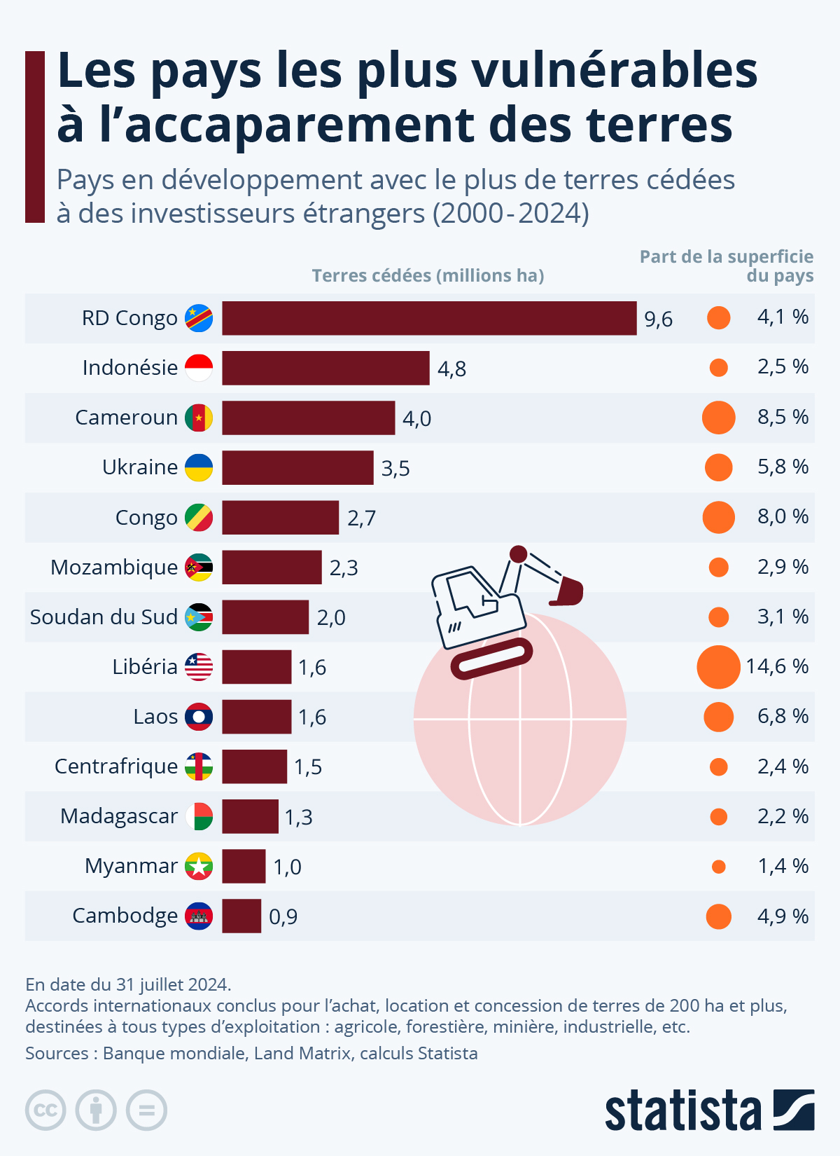
The German platform Statista published a study titled, “Countries Most Vulnerable to Land Grabbing.” Land grabbing refers to a large-scale acquisition of land, often by powerful entities, multinationals, corporations, governments, usually foreigners and frequently involving unethical or exploitative practices. They involve the purchase or lease of massive lands mostly in developing countries. These land-grabs often raise high human issues, such as lack of compensation of the locals, removal of local populations from their lands, and environmental degradation.

Map of the DRC
Map of the DRC

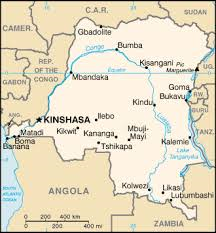
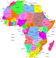
From Statista’s study, the countries most at risk of land grabs are, no surprise, in Africa and Asia. Out of the 13 countries on the top list, 8 out of the 13 are African. The Democratic Republic of Congo (DRC) tops the list, followed by Cameroon, the Republic of Congo, Mozambique and South Sudan. Liberia and Cameroon have sold the most: 14.6 % of the country of Liberia is in the hands of foreigners, while 8.5% of Cameroon is, so about 1.6 million hectares and 4 million hectares respectively. For countries like DRC or South Sudan, one could understand as there were wars in the country. But what about Cameroon? To be 3rd on the list, and have 4 million hectares (40,000 km²) of the country in the land of foreigners is crazy… To put it in perspective, 4 million hectares is roughly the size of Netherlands, Switzerland, or Denmark (excluding Greenland). Thus, the government of Cameroon has ceded land the size of the Netherlands to foreign interests between the years 2000 and 2024. This is without counting the ones ceded since independence… This is all done without the populations’ consent, and the countries almost get nothing, if not pennies? In Cameroon, majority of the companies are French, but there are also Chinese, American and more. As we saw in the case of Niger, or Cameroon with Safacam for instance, which has been there 130 years, but the road there is impracticable – they can grab everything, without even giving simple things like roads to the locals!

Map of Cameroon, with the capital Yaoundé

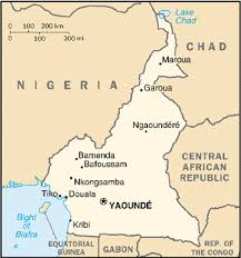
The Statisca survey goes on to indicate that the land acquired by foreign investors in Cameroon is primarily used for logging, mining, and industrial agriculture, such as palm oil production.

This is why African governments should be transparent, and expose every contract that they sign in our names and our children’s names so we know what is going on. African Governments should make Contracts Public to their Populations! They should take example on King Moshoeshoe I who banned the sale of the land of his ancestors to foreign investors. We should have a thing similar to the DOGE website to see all contracts!!! Moreover, if there is a call for contracts, how about our governments also open the call to locals? There are many Africans with great ideas!

Most Vulnerable Countries to Land Grabbing (Source: Statista – Banque Mondiale, Land Matrix)
 

Why the name: Brazzaville?

Map and Flag of the Republic of Congo

I always wondered where the name Brazzaville came from.  At first glance, it would appear to mean “the city of Brazza (la ville de Brazza).”  Is this a good guess? and if so, who was Brazza for his name to be given to the capital of an African country.  Fortunately or unfortunately, during European colonization, many African cities, and cities throughout the world, were renamed after the first European explorer passing by or after some European ruler.  Examples are countless: Leopoldville (modern-day Kinshasa), Port Louis (capital of Mauritius, named after Louis XV), Northern and Southern Rhodesia (Zambia and Zimbabwe resp. – named after Cecil Rhodes), etc. Other cities have seen their names ‘europeanized’ such as Canton (Guangzhou, in China), Bombay (Mumbai, in India), and many others.

Savorgnan de Brazza (by Paul Nadar)
Pierre Savorgnan de Brazza (by Paul Nadar)

Brazzaville is the capital and largest city of the Republic of Congo.  It is located on the shores of the Congo River.  It is the only capital in the world facing another one, Kinshasa, the capital of the Democratic Republic of Congo: Brazzaville and Kinshasa are separated only by the Congo river.  The Pool region and surroundings of Brazzaville had been an African crossroad for centuries.  In the Lari language, the regions of Mfoa and Mpila were known under the name Mavula, or “the place to get rich.”  Laris people still refer to Brazzaville that way; however the name Mavula is anachronic since in 1880, the region’s inhabitants were Bateke.  The site of the future capital was known as Nkuna, and was a Batéké village.  Brazzaville was founded on 10 September 1880 by an Italo-French explorer,  Pierre Savorgnan de Brazza, after whom the city was named, Brazza-ville or the city of Brazza.  The local leader, Makoko of the Téké, signed a treaty of protection with de Brazza which subjugated his lands to the French Empire (he was probably fooled by the French, as was common practice with the colonizers).  The city was built four years later in order to become a competitor with Léopoldville (now Kinshasa) which was built by the Belgians on the other side of the river.  The site was occupied from October 1880 until May 1882 by a small squad of troops led by Senegalese Sergeant Malamine Camara, who prevented the land from falling into Belgian hands.

Malamine Camara
Malamine Camara

It was actually Malamine Camara who created links with the local populations, and made them sign with the French.  Malamine was very loyal, and when Savorgnan left for France for a few years, Malamine stayed behind, and convinced the local populations through his good manners to side with the French.  It is so sad that today, history mostly remembers Savorgnan de Brazza, and that even that capital is named after him, when it was the Black Senegalese soldier who fought for the French, led the troops, and convinced the locals.

Aerial View of Brazzaville

The French officially established control over the area by the Berlin Conference of 1884.  The city became the capital first of the French Congo, and then of French Equatorial Africa, a federation of states which encompassed Gabon, the Central African Republic and Chad.  In 1924, the Congo-Océan railway was brought into service which linked Brazzaville with the port of Pointe-Noire.  During World War II Brazzaville, and the rest of French Equatorial Africa, remained beyond the control of Vichy France.  In 1944, Brazzaville hosted a meeting of the Free French forces and representatives of France’s African colonies.  The resulting Brazzaville Declaration was intended to redefine the relationship between France and its African colonies after the war.

Today, Brazzaville is a bustling city of more that 1.5 million inhabitants.  Affectionately called Brazza, it is the heart of the Republic of Congo.   To learn more about Savorgnan de Brazza himself, check out Brazza.culture.fr.  Enjoy, Brazza!